


© Yellowscan
Electronics Production |
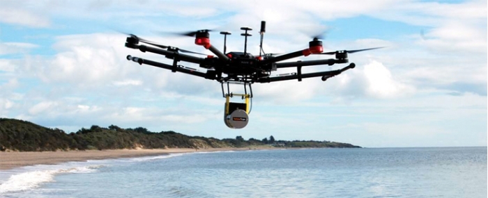
Velodyne LiDAR partners with YellowScan
Velodyne LiDAR, a provider 3D vision systems for autonomous vehicles, is partnering with YellowScan to integrate its VLP-16 Puck and VLP-16 Puck LITE LiDAR sensors into YellowScan’s Surveyor for a turn-key and reliable LiDAR system for demanding UAV applications.
By combining its LiveStation app with the real-time 3D data capture capabilities of Velodyne’s VLP-16 Puck and VLP-16 Puck LITE sensors – both of which feature a 360° horizontal field-of-view (FoV), 100-meter range, and weighing in at just 830 grams and 590 grams, respectively – YellowScan delivers a turn-key Surveyor system that can be mounted to any drone for short-time data processing needs.
“YellowScan is known for its commitment to providing reliable and easy to use sensing solutions for the UAV industry, which make the VLP-16 Puck sensors an easy choice for the Surveyor system,” said Erich Smidt, Executive Director Europe, Velodyne LiDAR. “The VLP-16 Pucks are some of our newest offerings, with significant effort put into reducing weight while maintaining the resolution and reliability expected of Velodyne’s industry-leading LiDAR sensors.”
“YellowScan Surveyor, the turn-key LiDAR solution integrating Velodyne’s advanced VLP-16 sensor, enables mapping professionals to do more in less time thanks to tremendously high density and accurate measurements acquired from UAVs,” said Tristan Allouis, CTO, YellowScan.